Jeff Mullen: 2019 Vermont Super 8 Ride Report
Earlier in the year I was excited to learn that the Vermont Super 8 Grand Depart (GD) was on and it was scheduled to start on a date that worked for me (9/27/19). I had previously committed to do the Butter Tart 700 (BT700) in Ontario in mid-July and the Alberta Rockies 700 (AR700) in mid-August which meant that I should be in excellent shape by the time the 640 mile Super 8 GD rolled around. The event would start and end in Montpelier (the center of the figure 8) and the south lobe (380 miles) would be ridden clockwise and the north lobe (260 miles) counter-clockwise. Riders could choose to do the whole route or just the north or south lobes.
Following are details and stories from the 7 day adventure that turned out to be more epic than I had anticipated. And at the end is info on my bike and gear for those interested in those details.
Day 1 (9/27/2019) –
Mikey Intrabartola and I showed up at the start (in front of Vermont’s Capitol building) around 7:15 AM and were the first riders there. Mikey, (from Elizabethtown NY) had stayed at our house (Richmond) and is the creator of the awesome 560 mile The Adirondack Trail Ride (TATR) event held in early September since 2015 in the Adirondacks. A very strong rider, Mikey was the favorite to be the first Super 8 finisher.
Soon Daniel Jordan showed up and other riders began trickling in. Daniel, along with being one of the co-creators of the route (with David Tremblay and Kris Dennan), was handling much of the organization and communication for the event. He was also planning to put down a fast time on the southern lobe (coming off a recent 3rd place finish in the very competitive TNGA event in Georgia) and would have been a co-favorite with Mikey in the full Super 8 if he had chosen to ride it.
Also riding the full Super 8 were Erik Nelson (NH), Jeremiah McRae-Hawkins (NH), Kevin Moyniham (NH), Taylor Valentine (CT), Joseph Dickerson (CT), Brian Oley (MA), Matthew Tschiegg (MA) and all the way from Winnipeg, Manitoba were Lindsay Gauld and Brian S (aka Vlad). 11 of us taking on the whole route though only 8 of us were being tracked on Trackleaders. Daniel (VT) would be joining us on the route south from Montpelier as the one rider doing only the south lobe and David Tremblay (VT), Nathan Sanel (VT) and Zaccur Fettig (MA) would be heading north to tackle the north lobe and its remote sections. 15 riders in all.
After everyone got acquainted and we received final instructions and inspiration from David and Daniel we were off at 8AM and made quite the scene as we headed down State Street on a busy Friday morning. Montpelier mornings this time of year are usually fogged in (due to cool overnight temps and the warm Winooski River) but I knew we would soon be climbing above the fog into bright sunshine so I didn’t overdress. We hit that first big climb within a mile and were soon in Berlin on dirt roads and trails that I had run, biked and skied as a kid having lived in Berlin from 3rd grade thru high school (my parents still live there).
The morning went by quickly and was a blur of friendly conversation, nice gravel roads and beautiful views broken up by tough climbs on rough roads and fun descents. We sliced thru corners of Northfield, Williamstown and Brookfield before hitting Chelsea and the first service option (which I skipped) around mile 30. I rode a bunch with Erik Nelson (from Bartlett, NH) during this stretch and enjoyed getting to know him a little. An avid rock climber in a past life this was his first long bikepacking event and he wasn’t sure how well he would handle long riding days in succession. He was on skinnier tires than I would recommend and thus was more cautious on the downhills but the stronger rider on steep ascents. One strategy I use is to walk any uphill that will get my heart rate up high and/or send too much lactic acid to the legs. My thinking being that conserving energy is important in these long events.
A big climb took us out of Chelsea and into the town forest. More fun riding as we hit nice gravel roads and rough 4th class roads thru Vershire and on to Strafford. Somewhere in this stretch I stopped for a lunch of pizza (I had saved a slice from the rider get together at Onion River Outdoors the night before) and baby potatoes. I often have stomach issues in these events and trying something new I had baked a couple pounds of baby potatoes to munch on the first few days of the ride. That, along with avoiding Clif Bars that always cause burping, may have helped as my stomach did much better than it normally does. Also in this stretch my bike started making some serious rattling sounds. When I finally stopped to check it out I was relieved to find that it was only a broken water bottle cage. To avoid losing the water bottle I moved it to my feedbag after spreading the feedbag contents among other bags.
Also between Chelsea and Strafford I ran into Daniel Jordan riding back towards me. Surprised and concerned to see him I called out “Daniel, what’s up?”. He had lost his Spot tracker and was backtracking to try and find it. I hadn’t seen it and suggested that it would be like trying to find a needle in a haystack and he should just continue forward. A bummer for those following his ride but no reason for him to change his strategy (which was an ambitious one – ride to Pete’s Camp at mile 121, sleep for a couple hours and then ride straight thru the next day and night and into the following day until he finished the 380 mile south lobe). Daniel agreed and took off in the right direction and was soon gone. This encounter reminded me of last year’s TNGA when I had run into another rider during the night riding in the opposite direction. After exchanging pleasantries we realized that we each thought we were going the right way. Only one of us could be right and fortunately it was me!
I stopped at the nice general store in South Strafford (mile 46) where Daniel and Erik were hanging outside about to leave and I grabbed food for a 2nd lunch. Then it was more of the same hilly back road riding as I headed south thru Norwich, Hartford, Pomfret and into touristy Woodstock which was very busy on a Friday afternoon. I went slightly off route into town to stock up for the night and morning at Mac’s Market before heading west out of town which included a stretch along busy route 4.
In Bridgewater the route turned south again and included a huge climb thru the Coolidge State Forest. At one point the GPS indicated a split in the trail and I realized it was a spur to recommended camping in the State Forest where I believe Erik and Kevin stopped for the night. I forged ahead as, like Daniel and a few others, I was hoping to get to Pete’s Camp (private land in Windham set up for mountain bikers and others to use) that night. A few miles later Daniel came up from behind as he had taken a longer break in Woodstock to communicate to family/friends why his dot on Trackleaders wasn’t moving. He was soon gone but I again came upon him as he was placing a trail marker where the forest road split which was opportune for me as I almost took a wrong turn there. I had several close calls with navigation that day as my GPS can be hard to read at times (due to the small/scratched screen). Often requiring me to stop and take an extra close look at it.
I followed Daniel on some fun/fast downhills thru Reading and onto gravel and eventually paved roads and was relieved to be following someone that knew the route for a few miles. Saving me from having to deal with navigation for a little bit. We quickly passed thru a corner of Cavendish into Weathersfield and onto smooth back roads before I lost him and stopped to eat and to put on warmer clothes (the day was cooling quickly once the sun started going down). Soon I hit the North Springfield Reservoir and more fun riding and then a quick stop at a gas station for some energy food before some easy riding to Chester. It was now 109 miles into the ride and Pete’s Camp was only 12 miles away and I was psyched that I would be there by 10:30 or so. After some tough climbs I finally turned onto the road that I knew would have me there within a mile (as we had ridden this road at the VT Bikepackers Bindle weekend last fall).
But after a few hundred yards I came upon a bridge completely covered with downed and tangled trees. It looked like a tornado had come thru (and I later learned that the rare Vermont tornado had done just that!) and the road looked impassable. My only thought was that I had to figure out how to get thru. Pete’s camp was just ahead and I really wanted to be there. I scouted left and right but there was no obvious way through this mess. Finally I plotted a possible course and hoped that the route would clear up if/when I made it over the bridge. After 20 minutes of dragging my bike under trees and branches and lifting my bike over others I was finally across the bridge but it was more of the same and now I was stuck in the middle of it. Again I scouted left and right and slowly moved forward scraping the heck out of my lower legs and working up a sweat despite the cool night. I made it thru this section after another 15-20 minutes but there was still more debris. This was getting frustrating! I worked my way thru another section of this and finally things cleared up enough to know that I would make it out. As I walked my bike up the last stretch of the hill things got very eerie as there were logs glowing on each side of the road as I assume they had been burning them as a way to get rid of debris. The gates of hell came to mind… Later thinking more clearly I wondered why I didn’t just try to figure out a detour - as Mikey, Jeremiah and Daniel must have done earlier that night and later riders were given instructions for.
After all that effort I then missed Pete’s Camp! I didn’t recognize the entrance in the dark but I came across a church just down the road and the grassy lawn made for a perfect place to sleep and by midnight I was in my sleeping bag. A little extra tired from my hour in the tornado debris.
Day 1 Statistics from my Garmin –
Distance – 123 miles
Climbing elevation – 13,950’
Day 2 (9/28/2019) –
I was up at 6AM – wanting to get away before anyone noticed me on the church lawn – and on the bike by 6:30. The day started with some trail sections that I was familiar with from the Bindle weekend last fall and I used lights until the day brightened. Fun riding and things went well until I got to a spot where the track seemed to end. Figuring that I had come to the end of track 1 (3 tracks were created for the southern lobe and 3 for the northern lobe) I switched to track 2 on my GPS but that started many miles away. Now I was confused and pulled up track 1 again and realized that it had some extraneous info and I was actually supposed to turn left onto another trail a hundred or so yards back. The first of several navigation issues I had that day…
Following some fun downhill into East Jamaica and a quick crossing of route 100 and the West River more climbing began which included a steep hike-a-bike section before more downhill brought me to the Wardsboro Country Store. For breakfast I grabbed a mix of fruit and high energy food and I plopped down on the porch. Jeremiah soon pulled in and I asked him what he had done when he got to the tornado area last night. He mentioned that a homeowner explained what had happened and told them it was impassable and Mikey (who he had been riding with much of the day) quickly figured out a detour. Jeremiah commented on my lower legs and called one cut a “flapper” as a triangular flap of skin was hanging down. I hadn’t really noticed and I wonder now if stitches would have been a good idea. I did finally get around to cleaning it out that evening and kept an eye on it to make sure it wasn’t getting infected and a few weeks later it is still pretty ugly.
I left Jeremiah at the store and expected him to pass me before long but after 10-15 miles I found myself totally confused. Being another sunny day I was again having trouble following the track (or “magic purple line” as I call it) on my GPS and wound up at a homestead where the trail seemed to end. I kept getting confused as to which side of me the track was on and was zooming in and out on my GPS trying to make sense of things. After 30 or so minutes floundering back and forth I backtracked to where I knew I was on the track and realized that I had missed a left turn (Upper Pound road) when I went straight on a road on the GPS (US Topo 100k maps are loaded) which I mistook for the purple line of the track. Not my proudest navigational effort and I’m sure Jeremiah passed me here.
Back on the route I made good time thru the Newfane Town forest and was now enjoying the beautiful morning until I got to the Brattleboro Watershed Forest. There was a lot of gunfire close by (a shooting range?) which was a bit unnerving and very annoying. And navigation became an issue again. I zoomed in on the track and thought I was doing well until at one point the purple line on my GPS started veering right where there was no trail. I continued on what appeared to be a trail to the left but when it diverged more from the GPS track I backtracked and tried again. I still couldn’t figure out where the track was trying to take me as it seemed to lead where there was no discernable trail. I decided to stay on the trail I was on in hopes that it was a glitch in the track and the trail would soon bring me back to the GPS track. No such luck and the trail I was on soon started to peter out. Zooming out on my GPS I could see that if I continued in this direction I would get to a road that I could take south where I could reconnect with the track. So I started bushwhacking and crossed a stone wall to get to a house where a long driveway brought me down to the road and after another mile or so I was back on track. More time lost and I still wonder if there was a track issue or just something I was misinterpreting. My goal was to get past Bennington today but that now seemed doubtful.
I then hit the Retreat trails just north of Brattleboro where Daniel warned us that there might be track issues and we should just stay on the Ice Pond Trail to get thru. I tried to do this but unmarked intersections still made things challenging (maybe just for me?). At one point I was again getting confused when I spotted one of the Super 8 trail markers uphill from where I was and that seemed to get me back on track. I probably lost a few minutes on these trails and breathed a sigh of relief when I made it out without major issues. Coming into Brattleboro I was once again having trouble reading my GPS in the glare of the mid-day sun and began following the spur track into town. I soon figured out my mistake and headed back in the right direction.
I quickly got to the Vermont Country Deli where I was looking forward to getting a sandwich but unfortunately it was mobbed on this beautiful Saturday afternoon. So I grabbed a few pre-cooked items from behind the counter instead and waited impatiently in the checkout line as the lady in front of me took her time ordering $67 worth of pastries… I felt like an alien amongst the tourists.
The rest of the afternoon was spent on beautiful roads (mostly gravel) as I headed west across the bottom of the state. I stopped in Halifax as a town celebration was wrapping up and purchased some lemonade and enjoyed the festive gathering for a few minutes. Then on to the village of Jacksonville (Whitingham) where I stocked up for the night. Eating half a sub on the porch of the general store and saving the other half for later.
It was now dusk as I continued west on more gravel and then another short stretch of route 100 before heading north up the west side of the Harriman Reservoir and some welcome flat riding. I was now in the Green Mountain National Forest (GMNF) and this 5 mile double track section got increasingly rough before the track turned west onto a tough 2 mile hike-a-bike climb which was followed by fun downhill back to route 100. I started to keep my eyes open for bivy sites as it had been a long day but kept going as I turned onto route 8 for a short stretch and then back roads towards the expected rough section to get to Bennington 10+ miles away. Still looking for a spot to sleep the decision was made when on the other side of the bridge over the West Deerfield River was a steep climb that I wasn’t up for. I also figured that I would need to treat water in the morning so I bivied close to the river where an old logging road entrance made for a small clearing next to the road. Here I got my 2nd straight night of decent sleep despite a little overnight rain.
Day 2 Statistics from my Garmin –
Distance – 86.5 miles (only 83 miles of progress on the route according to Trackleaders)
Climbing Elevation – 10,552’
Day 3 (9/29/2019) –
I was up before 6AM and packed and fueled up quickly before heading to the river to treat water. I was ready to go by 6:30 and turned on my Spot tracker and my GPS. It was a little hard to see in the early morning light but I went thru the usual routine of finding the appropriate track on the GPS (track 2 of the southern lobe) and selecting it and then selecting ‘View Map’ and ‘Go’. The map didn’t immediately pop up so I hit the Select button again and something didn’t look right. I now leaned in to see what I had done and was shocked to see that I had deleted the track! The Select button on the Etrex 30 is also used for toggling up and down and I must have accidentally toggled up to the Delete Track option before finally successfully hitting Select.
As the shock wore off my brain scrambled to come up with a solution as without navigation my race was done. Think! Well – I guess I’ll just have to figure out where track 3 starts (I later determined to be Rupert – 53 route miles away), figure out an alternate route to that point and finish unofficially from there. For a minute I also contemplated continuing forward thru the GMNF without navigation but was sensible enough to realize that would be foolhardy as the possibility of getting lost was real. Think harder! I knew Daniel had put the route on RideWithGPS so maybe I can find the e-mail with the link and pull up the route. Turning on my phone I wasn’t expecting to have internet access but I did (though only 1X service) and I also had cell service (1 bar) when standing on the bridge in the middle of the river where there was a break in the forest canopy. I still had Daniel’s e-mail and clicked on the link. It asked me if I wanted to open in the RideWithGPS app as I had it on my phone (which was a nice surprise as I don’t remember why/when I had downloaded it). It opened and there was the info that I needed and if I had a RideWithGPS subscription I could use my phone to navigate! I filled out the application info for a 1 month subscription and clicked on the Pay via Paypal button. But for some reason it wanted my Gmail password which I didn’t know (as I hardly ever use). I tried to reset the PW but the info they were supposedly texting me wasn’t coming thru. Luckily it was a Sunday morning and my wife Leslie would be home so I called her and walked her thru where the password was likely saved in a folder on my computer. She couldn’t immediately find it so I asked her to continue to look and text me if she did. A few minutes later I got the needed text from her and I finished setting up the subscription and was still in the race! The backup navigation plan that I didn’t know existed and I was on the bike at 7:30 – a stressful hour later than planned.
When I had turned my phone on it was 65% charged and it was now down to 55%. I plugged it into the USB port that is fed from my dyno hub and hoped that I would be going fast enough to provide a little juice to the phone. I also put it into airplane mode to help conserve the battery. I didn’t have a place to mount the phone but realized that it fit snugly in the side pouch of my feedbag and I could quickly pull it out with my right hand and activate the screen with my index finger, swipe with my thumb and check the track without stopping. I would need to do this a lot to stay on route for the next 53 miles. At times I was zoomed in too far and flew past a few downhill turns before they appeared on the screen but eventually I got used to the app.
10 or so tough miles later (which included a very rough descent) I was in Bennington. I stopped at a café and immediately plugged my phone in (now down to 45% charged) and ordered a bagel and a smoothie. Letting the phone charge was a nice excuse to relax for 30 minutes before continuing thru Bennington. I had never seen the Bennington Battle Monument, as I seldom get to this corner of Vermont, so that was cool and I was impressed by the beautiful grounds and the nice historic looking homes in this section of town.
I don’t remember much about the 20 miles from Bennington to Arlington but they were relatively easy miles with a lot of turns (so a lot of checking the phone to stay on route). I stopped at the Stewart’s Shops in Arlington to grab some lunch and to charge the phone a little more (still hanging in the 50-60% charged range) and was amazed at how loud the place was. Loudest shop I’ve ever been in as everyone seemed to be yelling. Maybe because free coffee was being given out that day which – not being a coffee drinker – I didn’t take advantage of.
Out of Arlington was a beautiful 10 mile stretch west along the Battenkill river that took us briefly into NY before turning north again onto gravel roads. At first a big climb and then some rollers before some long fun downhills into Rupert. I stopped in the center of the tiny village for a minute and as I was getting ready to proceed the RideWithGPS (or my phone’s GPS) started going crazy. All of a sudden it looked like I was off route and needed to backtrack a mile or so. I started back and the info kept changing on my phone but eventually seemed to correct itself and I returned to where I had been and continued from there. Coincidentally the rail trail started in Rupert and that was where track 3 of the southern lobe started. I had loaded it previously and was just waiting for it to show up on my GPS. If I had checked it a little earlier I could have avoided losing time backtracking.
With the phone now put away it was time to enjoy some easier rail trail miles. The 10-12 or so miles to Granville, NY went by quickly though I mistakenly stayed on the rail trail thru Granville to Middle Granville when it appeared that the actual route was a couple hundred yards to the west on a road. At a big dairy farm I was forced to the road and made a quick stop at a convenience store before heading on backroads to Poultney, VT. Enjoying the easy backroads cruising I realized at one point that I was off route. Zooming out on my GPS it looked like I had missed a left turn about a half mile or so back. Not again! But before long I was in Poultney and at another Stewart’s grabbing some dinner and stocking up for some night riding. Leading out of Poultney would be another easy section of rail trail and I put music on for the pleasant ride as it started to get dark. But after a while I realized that I was again off track and possibly closer to a mile this time. Supposedly I should have turned left but I don’t remember seeing any turns off the rail trail. So I backtracked and found the left which was a road that went thru an underpass under the rail trail. In the dark I didn’t see an easy way down to it so I struggled down a steep rocky hillside and then along a rock wall until I could get to the road. At one point I fell onto my bike and was a little worried that I might have broken a spoke but all was good.
After a mile or so the route turned north and soon I was cruising up the west shore of Lake Bomoseen wishing it was daytime so I could be enjoying the lake views. From here it was a mix of gravel roads and paved roads with a couple good climbs thrown in on the way to Brandon. And at some point there was some rough 4th class roads marked ‘Private’ with a couple barking dogs very distressed that I was passing thru in the dark. This section was new to me and I had no idea where I was or what compass direction I was heading as I followed the track on my GPS. Finally I made it to Brandon where I planned to sleep as there were major climbs past town that seemed best left for morning. It took a while to find an acceptable bivy site and I wound up behind the Brandon Inn under a shelter with a concrete floor which was very cold and didn’t make for a good night’s sleep. I later learned that Jeremiah also had slept in Brandon that night and that Mikey (who had ridden thru the previous night with Daniel) had finished the South lobe in Montpelier earlier that evening and had decided not to continue with the north lobe. Erik had been sleeping more than I had and was now 50-60 miles back while the other riders were farther back.
Day 3 Statistics from my Garmin –
Distance – 118 miles (113 miles of progress on the route according to Trackleaders)
Climbing Elevation – 8,908’
Day 4 (9/30/2019) –
I was up before light on a very cold morning (overnight temps in the 30’s) and backtracked about a quarter mile to a gas station store for breakfast and a chance to warm up. Then it was up and over paved Brandon Gap to the beautiful village of Rochester where I stopped at a café for more food and phone charging and a quick check of e-mail and Trackleaders. This is where I saw that Mikey’s dot was still in Montpelier and I hoped that he was just catching up on sleep. I texted him to see what his plan was for the north lobe and Mikey responded “…I decided to just do the southern loop. I was happy with my result and not sure a northern loop would yield the same results”. I was happy that he had had a great ride but was disappointed that he wouldn’t be out enduring the north lobe ahead of me. I had no chance to catch him but I had hoped to lessen the gap if/when his body started demanding more sleep.
After another quick stop at the local grocery store I was off for a short stretch north on route 100 (I’ve mentioned a bunch – this is a 200 mile scenic state highway that runs from the top of the state to the bottom of the state and is popular among tourists and long distance road cyclists) before turning east onto gravel. A tough climb followed and then some nice flats and rollers with beautiful views before turning east for the Braintree Gap. This is a rough 4th class road and was just recently added to the Super 8 route. I had ridden it once with a friend maybe 25 years ago and fortunately my memory of it was worse than the reality. There was a bunch of hike-a-bike and 2 miles of rough descent but it went by quickly. There wasn’t much of a respite after I popped out onto route 12A as the route soon turned east for more climbs on scenic gravel and remote roads towards Northfield. I had been playing music much of the day and it really helped as I was getting amped up as I sang along and spontaneously started bouncing the bike at times to the beat (an example of why I don’t drink coffee). Excited that I would be finishing the 380 mile south lobe that afternoon.
The route eventually dropped back down to Route 12A and it was a nice cruise into Northfield past Norwich University and I stopped for lunch at a Subway. I read a few e-mails and folks were starting to wonder if I would continue past Montpelier onto the north lobe. I had never doubted that I would but with rain likely moving in over the next few days I knew it might be a bigger mental challenge than I had anticipated. But first I needed to get there and I soon took off for the final backroad 17-18 mile stretch of the south lobe. After yet more climbs and rough roads I hit the downhill and then flats before Montpelier. A few miles out I saw my sister Gail alongside the road getting a few pictures and I stopped to chat. When I hit town around 4PM I stopped at my car (which was legal for this event – though had triggered some debate before the race) and grabbed the rain pants that I had decided to not carry on the south lobe along with a few energy bars and drank a Gatorade. Also in my car was a bike pump, an extra tube and Stans sealant just in case. I could have driven home in 25 minutes and been sleeping in my bed that night and I began to think that allowing us to access our cars was an evil plot to add to the mental challenge of completing the Super 8!


As I was leaving the parking lot I saw Jeremiah riding by the other way and I yelled out to him and we chatted for a few minutes. I hadn’t seen him since the morning of day 2 and wasn’t sure if he was ahead of me or behind (he wasn’t carrying a Spot tracker) as I wondered if he might have dropped back to ride with his friend Kevin. Jeremiah had gotten to Montpelier a few hours earlier and had already stopped at the 3 Penny Taproom for a post ride beer and was heading back to his car for the drive home to NH. Now I knew I was in the unfamiliar position of being the lead rider but I would have been happier chasing other riders ahead of me.
With lots going on in my mind I stopped at the Montpelier Subway and ate another meal and saved a half sub for later that night. The clouds had been building and it looked like it might rain any minute. I didn’t want to quit but I was certainly struggling with a lack of motivation as I finally left town around 6:00. It helped though to know that I had a destination for the night planned (New Discovery State Park in Groton State Forest) and that I was familiar with the north lobe from a June training ride. By the time I had done the climb to the outskirts of Montpelier it was already dark and I decided to call Leslie as she was likely now home from work. Still no plans to quit (though it would have been an easy downhill coast to my car from there) but a pep talk would be nice. We chatted for 10 minutes and she reminded me to be careful as the weather forecast looked nasty. I pushed off for the climb up Murray Road which would bring me out of Montpelier and after a while bright lights across the valley in Berlin caught my attention. This was the Central Vermont Medical Center complex and included the Woodridge Nursing Home where my mother now lived with mid/late stage Alzheimer’s. Remembering that I get my perseverance from her and how supportive she had been of my riding (includes sewing my panniers together from a Frostline kit for a cross country ride when I was 24) my motivation returned…
On past the farms of East Montpelier and Goddard College in Plainfield (where Bernie Sanders’ political career began with the Liberty Union party) and onto the rail trail/path that led into the Groton State Forest. This was easy/fun riding until a mile or 2 from the campground when the route turned onto a rougher section of rail trail. But soon enough I was back on good road and at the state park. My plan had been to look for an empty lean-to but in the dark I took the first site that looked nice and was close to a bathhouse where I could keep my bike under cover in case it started to rain. The picnic table was narrow but I went ahead and set up my sleeping pad and my sleeping bag inside my bivy sack on top of the table to sleep. Unfortunately it started to rain overnight and I was having trouble keeping water out. And at one point while rolling over I rolled right off the table onto the bench and then onto the ground. Getting back to the top of the table got me even wetter and I started to wonder how it was possible to make so many stupid mistakes!
Day 4 Statistics from my Garmin –
Distance – 87.6 miles
Climbing Elevation – 9,341’
Day 5 (10/1/2019) –
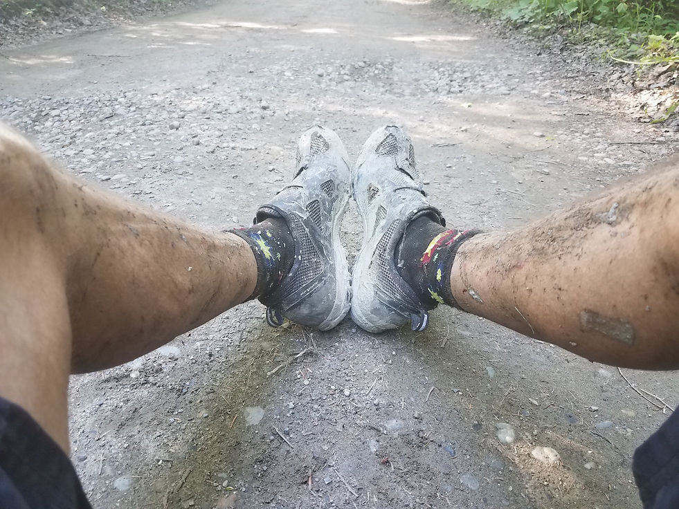
The first morning of October definitely felt more fall like (foggy, misty rain and cold) and it was tough to get moving as I was tired from a 2nd straight night of poor sleep. The bathhouse wasn’t as cold so I carried my sleeping gear in there and hung it up over several stalls to dry a little. There was a shower but I figured it was best to stay as feral as possible and I didn’t have quarters anyway. I wanted to be good and warm before hopping on the bike so I took my time eating breakfast, brushing my teeth and packing up. I also took my only pictures of the ride as I got a couple shots of my puffy face (what I call “bikepacker face”) for posterity. Fortunately I don’t usually get the swollen feet and ankles that are also common among bikepackers.
It was almost 8:30 before I was off and I quickly toured the campground to find the lean-to section - just in case there is a next time - and boy they looked comfy… The route exited the back of the campground via a double track trail that was a little rough but not too muddy. Then nice backroad riding past beautiful Peacham Pond before popping out briefly onto Route 2 in Cabot before turning back onto nice gravel roads that would take me thru Peacham and Barnet and would eventually hook up with a section of the Lamoille Valley Rail Trail (LVRT) in Danville. The fall colors were closer to peak on the northern lobe and the riding was beautiful this morning. After a short distance on the LVRT I came to Marty’s First Stop and some much needed refueling and restocking. Then more easy rail trail riding to St. Johnsbury and then hillier back road riding to Lyndonville. Maybe halfway between St. J and Lyndonville a pickup truck stopped in front of me and Nathan Sanel jumped out. Nathan had been the first finisher of the 3 north lobe riders and it was great hearing about his ride and sharing tales from my ride. This was Nathan’s first bikepacking event (though he has a lot of ultra-running experience) and his enthusiasm definitely gave me a boost when I resumed riding.
The White Market in Lyndonville was on route so I stopped for more food and their prepared foods section was awesome. You pay by weight and I filled my plate with everything my body was craving and also grabbed a few slices of pizza for later that night as there were no services on route for the next 60 miles. A few pounds heavier I was glad there was some easy riding before hitting Darling Hill Road and the gravel climb up to Kingdom Trails (KT) in East Burke (called the best trail network in North America by Bike Magazine). I stopped at the Village Sports trailhead and chatted with a few riders but figured I better get thru the single track section before it rained (it had been threatening all day but only sprinkled a few times so far) and hopefully get over/around Burke mountain before dark.
The first section of KT single track was fun/fast riding but then I hit the section that had recently been added to the route. The trail was muddy and rooty and the riding and navigation became more challenging and I wondered if this section was closed as I didn’t see other riders. A few showers passed thru and I stopped under trees to stay dry when spurts of heavy rain fell. I finally hit a road that led to a short stretch of Route 114 before turning onto Pinkham Road and the start of the climb towards Burke Mountain. I began hearing the rumbling of thunder and soon started seeing flashes from lightning and hoped I was close to the ski area where I could look for cover if needed. But the route turned onto a double track trail and began descending. Fortunately I popped out into a clearing where there was a small building and a large parking lot just as it started to rain hard. I pedaled quickly to the building and was psyched to see that it had a nice dry porch and was deserted. This was the Burke Mountain nordic center where I felt quite at home being an avid nordic skier.
I had gotten there just in time as it was now a heavy downpour. It was only 5 o’clock and I figured it was a great place for a short break (I even had 4G internet access) so I sat down to wait it out. After an hour it was still raining hard and I checked the radar on my phone and it looked like the deluge might continue for quite a while. I ate my slices of pizza and called Leslie and decided I should probably just settle in and catch up on sleep. By 7:00 I was laying in my bivy sack on my sleeping pad (my still wet sleeping bag hanging on a nail above me) just a couple feet from the heavy rain and I don’t think I could have felt cozier if I was at a 5 star hotel. This would be my shortest day ever in a bikepacking event and the rain continued until early in the morning.
Day 5 Statistics from my Garmin –
Distance – 61.4 miles
Climbing Elevation – 5,328’
Day 6 (10/2/2019) –
I woke early and more refreshed than I had been in a while and was on the bike before 6AM, a bit before first light. Just a couple hundred yards down the gravel road from the nordic center the route turned left onto a trail and fortunately there was a bridge across the stream that had to be crossed as it was raging after last night’s monsoon. I hoped the rain didn’t make for extra muddy conditions and/or trail damage that would slow me down today.
Soon I popped out behind some condos and then onto paved side roads where after a couple quick turns I was on Mountain Road and then the Toll Road for more climbing on Burke Mountain. There is a campground at the toll booth and I stopped in hopes of filling water bottles but the campground appeared to be deserted (heavy rain will do that I guess) and I couldn’t find a water spigot. So I continued up the Toll Road as it got steeper figuring that finding water to treat wasn’t going to be a problem... Within a half mile I came to the right turn for the old/rough CCC road where the route cuts across the mountain - crossing over ski trails and under several ski lifts - at an easier incline until you top out on the western flank of the mountain near the 2nd of 2 lean-tos..
I had been listening to music since I turned onto Mountain road (always makes climbing easier) and at the top I stopped to unlock the front shock for the rough/rocky 2 or so miles of downhill. This was fun riding but a section that you feel good getting past with both the bike and body unbroken. As the trail leveled and opened up into a clearing at the bottom I stopped to rest my hands and to again lock the front shock. I immediately noticed that my dry bag was missing from my handlebar sling. Damn… By looking down the trail - to plot the descent thru the obstacles - I hadn’t seen it fall off. And because I was listening to music I hadn’t heard it fall off. The drybag contained my sleeping bag and my down puffy jacket and these would be essential for the cold temps that were forecast for that night. I briefly considered not going back to look for the drybag, figuring I could buy replacement gear in Island Pond later that morning, but came to my senses and started back up the trail. At first on foot - not wanting to ride back up the hill - but after maybe 50 yards I turned back for the bike as I didn’t know how far up it would be and walking back down the trail would be slow. Fortunately I found the bag in the middle of the trail no more than a half mile up and I only lost 35-40 minutes. Since the dry bag was green I was afraid it might have bounced off the side of the trail and been hard to spot.
Hopefully that was my last mistake of the ride and I settled in for the fun/remote riding thru Victory, Granby and Ferdinand. When I had ridden the north lobe in June we went thru the Victory Basin at dusk and I absolutely loved this section and it’s Alaska like feel (to me anyway). This morning it appeared to be much wetter than I remembered with water right up to the edge of the road on both sides. I imagined myself being in the deep south where I might have been wary of critters in the water and I found myself edging closer to the middle of the road at times.
After winding 15+ miles northeast from Victory the route turned almost due north onto a double track that led under power lines for 4 miles. The fall foliage was absolutely spectacular along this section but after a while I climbed into the low clouds and it got colder due to misty/wet conditions. A quick stop for warmer clothes and then I rode the last 8-10 miles of forest roads to route 105 (which included a few hundred yards of very narrow single/no track at the end) and then the almost 10 paved miles west into Island Pond to restock at the grocery store.
I had to backtrack a little from Island Pond to get back on the route which turned north onto a nice gravel road that eventually got rougher (with lots of climbing) and petered out into a swampy double track thru Lewis and Averys Gore (my waterproof Showers Pass socks were a key piece of clothing this day) before connecting back into good dirt roads before a fun descent into Warren Gore and hitting route 114. I remember this downhill being faster and more fun in June as I think the heavy rain had caused some erosion on this seldom used road and soft sand had collected in spots requiring caution on the bike.
After a few minutes north on 114 it was back on gravel roads past the southwestern end of Norton pond before climbing into a section where good road again turned into a rough/swampy section before getting back on good roads in Holland and smooth riding with a few climbs before a good descent into Derby Line on the Quebec border. At one point before reaching town a chubby kid (maybe 11 or 12 years old) wearing shorts and a t-shirt (it was late afternoon and starting to get very cold) came barreling down a side road and seemed keen on racing me. I was happy to oblige and quickly left him in my dust thinking that they must raise them tough and a little crazy up this way.
I stopped at the Irving gas station convenience store for more food and to relax a bit. It was definitely an interesting spot to people watch and I wondered what it was like to live in a place that is physically 1 town split by an international border (Derby Line, VT and Stanstead, Quebec). By the time I got rolling it was dark and after 4 paved miles I was on the bike path that took me down the southeastern side of Lake Memphremagog (which is also split in half by the international border) to Newport. There I again stopped for food and a break as I was mentally preparing for what I expected to be a late night of riding.
I was pedaling again by 8:30 and rode on paved roads out of town and eventually up the rough 4th class road climb to get to South Newport and then more hilly gravel roads before getting to another rough section that sliced thru the bottom of Troy and then smoother back roads towards Lowell before turning up the very rough double track to begin the climb over Lowell Mountain. It was past midnight - the going had been slow on the rough sections - as I began the slog over the mountain and I walked sections that I would normally ride (up and down) to stay safer in the dark and still wet conditions. A mile or so after starting the descent on the eastern side of the mountain I came across a clearing where there was an old picnic table where I finally stopped for a few hours of sleep around 3AM. A longer day that I felt I needed to get in after the previous day had been cut short by rain.
Day 6 Statistics –
Distance – ~ 114 miles (from ridewithgps info - based on where I slept on nights 5 and 6)
Day 6 and 7 were not split into separate files on my Garmin (see day 7 for these combined stats)
Day 7 (10/3/2019) –
I had left my sleeping bag (still a bit damp) packed on the bike and had tried to sleep wearing my down Swix jacket inside my bivy sack (on top of the sleeping pad) but that hadn’t gone well as it had been a very cold night. Still I packed up in a great mood around 6AM, knowing that I would be finishing later that day (happy hour was the goal). I always think of the last day of a multi day bikepacking event as “race day”. Since there is no need to save energy for tomorrow I usually push hard on the last day and feel much more competitive, usually looking to maybe catch or hold off a rider or 2. But with no one ahead of me and no one close behind the goal was just to finish and hopefully post what might be considered a respectable time.
The remaining descent on the rough mountain road was very cold but soon I was back on smooth gravel roads for a series of uphills and downhills before one long downhill brought me to Lake Eden. I loved the short stretch along the shoreline before hitting route 100 for the 2 miles of pavement that brought me to the Eden General Store. I ate a decent breakfast on the cold picnic table outside the store and then headed down the gravel road past the cemetary to the flat stretch that would bring me to the backroad section over this hills of Hyde Park to Morrisville. I’ve done this section several times and after the tough climb up Cooper Hill road it is nice riding and a super fun downhill into Morrisville.
When I got to Cooper Hill road however, there was a ‘Road Closed’ sign at the bottom. Hmmm… I figured I could probably get around whatever had it closed so I started up the steep climb. After a quarter mile or so though I came across a couple of town trucks and one guy came running towards me spinning his skyward pointing index finger. What I understand to be the universal sign for ‘turn around now dumbass!’. I stopped and as pleasantly as possible asked him what was going on. “We’re replacing a culvert. The road will reopen late this afternoon”. I then asked if there was any way for me to get around their work. I said that I wouldn’t mind cutting thru the woods (the road was in a bit of a gully so this might have been difficult) but his response was “Absolutely not”. And he said “route 100” when I asked if he had any suggestions for getting to Morrisville. He had been nice enough and I didn’t want to be disrespectful and push it but later wished I had asked for detour suggestions to the top of Cooper Hill.
I coasted back down the hill and continued towards route 100, stopping every so often to check for an internet connection. I was hoping to figure out how to get back on route as soon as possible but after wasting a bunch of time I gave up and rode to the village of Hyde Park and then hopped on the section of the LVRT that I knew would bring me to Morrisville and get me back on route. This detour really had me bummed out as I felt guilty not riding the hillier official route and irrationally wondered if anyone would question my decisions. In Morrisville I stopped at the Railroad Cafe for a quick snack and to e-mail Daniel and others explaining why I had detoured. Still a bit bummed I headed back out for the flat 12 mile stretch to Hardwick. Much of this was on the LVRT which should have been easy riding but this was a stretch where work hadn’t been completed (and wasn’t officially open) and they had recently dumped stones onto several miles of the trail which made for bumpy/slow riding.
Finally I hit Hardwick and cruised thru the center of town to the gas station convenience store at the bottom of Buffalo Mountain Road. This is the beginning of a 10+ mile stretch that includes a rough, somewhat technical climb followed by a long mainly flat section along the west side of the Woodbury Mountains (4th class road, then smooth gravel roads and then back to rough 4th class roads) then more rough/technical climbing followed by a very rough descent on the old Woodbury Mountain road. I had ridden this section twice - both times in June (2018 and 2019) when sections were very muddy and both times in the evening when I wound up doing the final rocky descent in the dark - and I had recently tried to talk Daniel into axing this section in favor of the more pleasant gravel northern end of County Road. Figuring that after 600+ miles Super 8 riders deserved an easier cruise to the finish. But Daniel had nixed that idea and I fueled up and got psyched up for the difficult riding. Finishing off a Coke and starting up my favorite playlist (labeled “Fast” - fast music for hopefully fast riding) I headed out of the parking lot at exactly 1:45 determined to now ride hard to the finish in Montpelier. Likely it was the caffeine but my body really responded and I hammered the uphill and then the flats and imagined that I was shooting for an FKT or a KOM on Strava (which I don’t use). I was cleaning technical sections that I don’t think I could have ridden better on an unladen bike or with fresh legs and was loving being in the zone. I missed a few of the best lines on the downhill stretches but hit the bottom of Woodbury Mountain at 3:24 just as my playlist ended. 1 hour and 39 minutes for that section and wow it felt great. Now I was glad that Daniel had left that piece in as I won’t soon forget how fun that had been!
Just 15 miles to the finish and I cruised thru the beautiful gravel sections of Calais, Adamant and East Montpelier to the 2.5 miles of single track trail that would bring me into Montpelier. Fortunately I had also ridden this section before and I knew it would take a little time and effort but it was fun riding and soon I was on Elm Street heading into downtown Montpelier. Of course I needed to make one last mistake as I assumed the route stayed on Elm Street (the most direct route to the finish at the State Capital building) and I missed a turn that took the route to Main Street (before the final turn onto State Street) and I had to backtrack one more time. My sister Gail had been parked at the bottom of a hill 3-4 miles from the finish and I flew by her but she was now waiting for me at the finish with drinks, snacks and congratulations which were all greatly appreciated. I had finished at 5:25 (the happy hour finish I was hoping for) for a time of 6 days, 9 hours and 25 minutes. A bit over my goal of under 6 days and a soft record which I hope to be among those breaking next year . A beer or 2 at Three Penny Taproom had been the plan (to celebrate my 14th GD finish in 14 starts in the 14th state - if only they had 14th Star beer on tap!) but now all I wanted to do was drive home, shower, eat and sleep…
Combined Day 6/7 Statistics from my Garmin –
Distance – 182.5 miles (~ 68 miles for day 7)
Climbing Elevation – 14,527’
7 Day totals –
Distance – 659 miles
Climbing Elevation – 61,800’
Finish Time - 6 Days, 9 hours, 25 minutes
Bike and Gear Info -
Bike - Specialized Epic 29er HT (it had originally been a 2012 Stumpjumper until I broke the frame during the 2017 The Adirondack Trail Ride (TATR) GD – Specialized replaced the frame via warranty with the Epic frame); 2X10 gears and a SRAM GX rear derailleur; Rock Shox Reba fork that is probably due to be replaced; Ergon grips that also are probably due to be replaced; aero bars that were great for the long smooth downhills and windy flats and gave me a place to hang my helmet on the hot climbs.
Wheels - Stans Notubes ZTR Flow EX wheels built up in 2015 with an SP PD-8 Dynamo Hub up front and a DT Swiss 350 Hub in the rear (I’ve gotten a lot of miles and events out of these wheels so far).
Tires - I knew it was time to replace the worn 2.25 Maxxis Ardents that I had been running for over a year but I didn’t want to buy new tires so I went with a 5 year old pair of 2.2 Continental Race Kings that I had in my basement that looked to be in good shape (chosen, with guidance from my LBS, over slightly more worn Maxxis Ikon’s). My LBS set these up tubeless (not trusting myself to handle the task before a race) and when I picked up the bike I noticed they were a little soft and leaking air along the rims. I added a couple more ounces of sealant to each tire at home and did what I could to speed up what I heard could be a 3 day sealing process. But right up to race morning (3 days after put on) they were still bubbling some around the rims but fortunately no issues during the ride.
Lighting – I was using a K-Lite handlebar mounted light that is powered from my dyno hub. This was purchased in 2015 and the setup has worked well since then. The light is very bright when riding at high speed and includes a built in standlight that still allows decent light to be produced at low speed and when stopped. Unfortunately the standlight feature was having issues before the ride which I wasn’t able to resolve. I also use a Fenix helmet light to help read the GPS at night and for extra lighting when hike-a-biking or going very slow. And I carried 2 small headlamps as backup. And my rechargeable rear blinker light to stay safer at night and on busy roads during the day. I had found this laying on a trail somewhere and without a mount for it just duct taped it to the seat tube (above the top tube).
Navigation – 6+ year old Garmin Etrex 30 GPS. This desperately needs to be replaced as the small, scratched and smudged screen is becoming increasingly difficult to read (especially on sunny days) and caused me to make several mistakes during the ride. As always I was pushing my luck with no backup plan for navigation. I also had a small bike computer so I could easily see current mileage to help determine when services were coming up (based on services info provided by organizer Daniel Jordan).
Bags/Clothing/Sleep Gear, etc. – Revelate Designs Viscacha seat bag that held an extra tube, my Neoair sleeping pad, my Mountain Hardwear Gore-tex bivy sack and a small dry bag with extra shorts, shirt, leggings, waterproof socks, gloves and a hat. A larger drybag containing my sleeping bag and puffy jacket (and at times rain jacket and other light jacket) was strapped to the handle bars with what used to be part of a poorly designed (imo) Revelate Designs harness system (they later greatly improved it). A Revelate Designs Tangle half frame bag contained another extra tube, bike tools and pump, headlamps, charging cords, music player, snacks and my wallet and phone. Using a half frame bag left room for 2 water bottles in the triangle. A Revelate Designs Feedbag (hangs off the handlebar) for much of my food and the outside mesh pouch makes a good place to stuff bar/candy wrappers, etc. A Revelate Designs Top Tube bag carried Aquamira (water treatment drops), chain lube, duct tape and usually a few more snacks. I also carry a small backpack where I kept my sunglasses and at times could be empty but at other times could be quite full as it is a great place to hold bulky food items and to quickly stuff clothes as the day warmed up and to retrieve clothes when it cooled down again.